- Posts: 5026
- Thank you received: 440
- Forum
- Open Forum
- Miscellaneous Research Topics
- General Airfield or 20th Century Military Architecture Discussion Topics
- Boundary Marker Stones
Boundary Marker Stones
- carnaby
-

- Offline
- Platinum Member
-

Less
More
05 Jun 2011 19:35 #21
by carnaby
Plan A is always more effective when the problem you are working on understands that Plan B will involve the use of dynamite
Replied by carnaby on topic Boundary Marker Stones
Plan A is always more effective when the problem you are working on understands that Plan B will involve the use of dynamite
Please Log in or Create an account to join the conversation.
- Denis
- Offline
- Elite Member
-

Less
More
- Posts: 1102
- Thank you received: 2
05 Jun 2011 19:52 #22
by Denis
Replied by Denis on topic Boundary Marker Stones
If you could see the wall it is an old structure that used to carry on to the left. The building of the fire Station in the 1960's may have put paid to the rest of the wall.
Please Log in or Create an account to join the conversation.
- Richard Drew
-

- Offline
- Elite Member
-
Less
More
- Posts: 1181
- Thank you received: 13
05 Jun 2011 21:00 #23
by Richard Drew
Richard
www.atlantikwall.co.uk
Replied by Richard Drew on topic Boundary Marker Stones
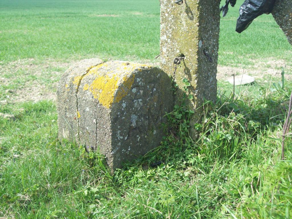
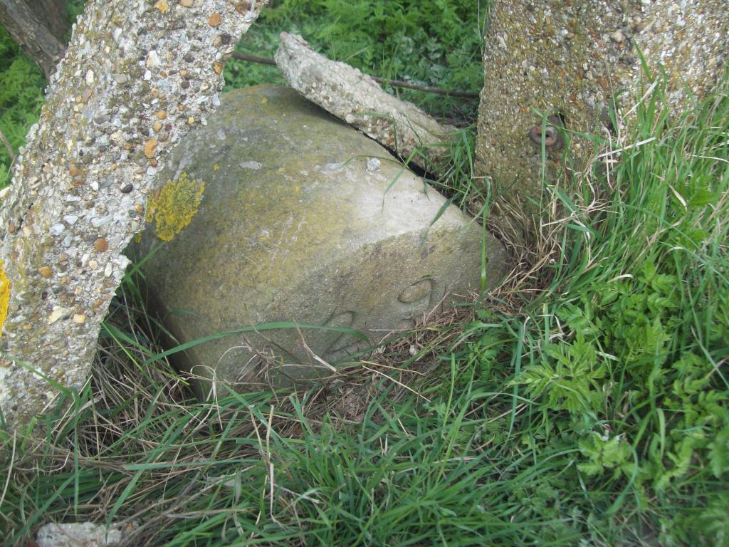
[IMG]/community/76349=4804-Sopley 800-02.jpg[/img]
[IMG]/community/76349=4803-Sopley 800-01.jpg[/img] Sopley, Hampshire. Passing and noticed this one, there may be one on each corner?
Richard
[IMG]/community/76349=4803-Sopley 800-01.jpg[/img] Sopley, Hampshire. Passing and noticed this one, there may be one on each corner?
Richard
Richard
www.atlantikwall.co.uk
Please Log in or Create an account to join the conversation.
- creynolds
-

- Offline
- Junior Member
-

Less
More
- Posts: 29
- Thank you received: 0
18 Nov 2011 19:57 - 20 Apr 2018 09:48 #24
by creynolds
Replied by creynolds on topic Boundary Marker Stones
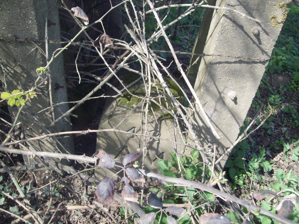
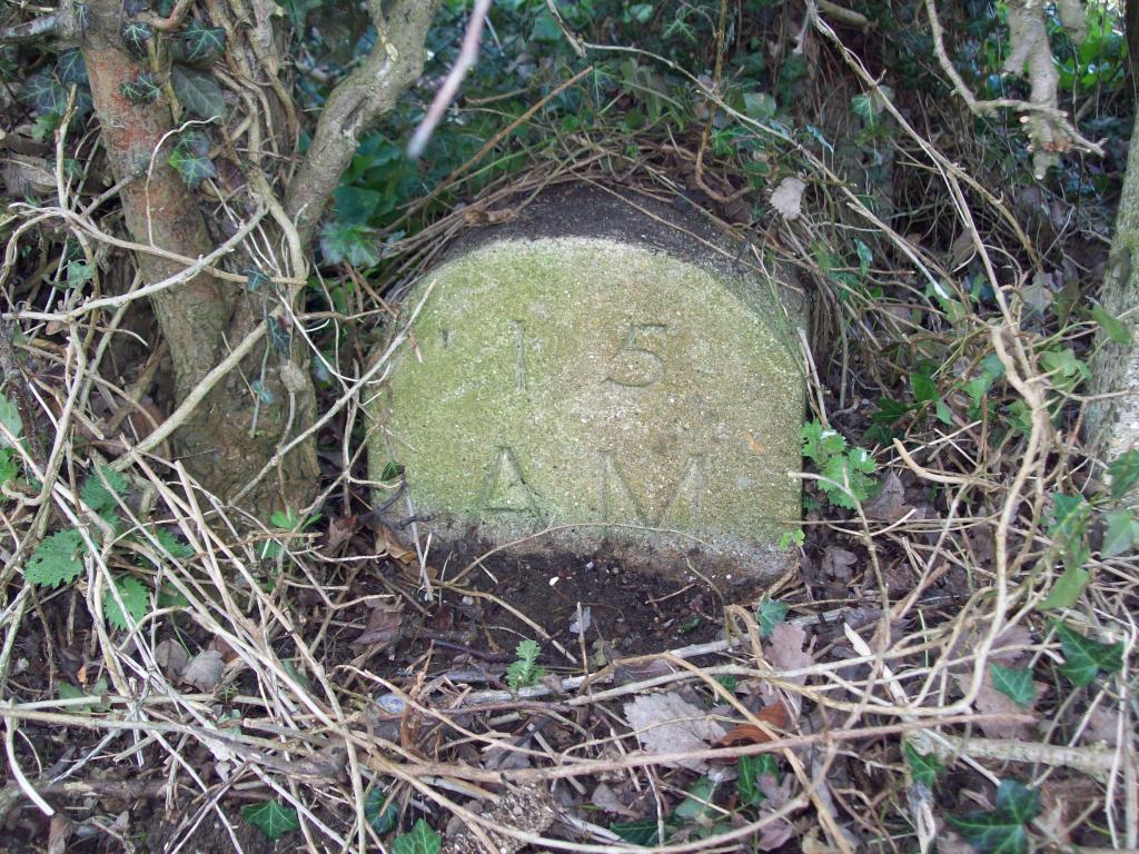
Here are a few of the AM boundary markers that I have found on my travels around the outskirts of Duxford Airfield.
[IMG]/community/89451=6774-Remains of Du 019.jpg[/img]
This image is hidden for guests.
This image is hidden for guests.
This image is hidden for guests.
This image is hidden for guests.
This image is hidden for guests.
This image is hidden for guests.
This image is hidden for guests.
[IMG]/community/89451=6774-Remains of Du 019.jpg[/img]
This image is hidden for guests.
Please log in or register to see it.
This image is hidden for guests.
Please log in or register to see it.
This image is hidden for guests.
Please log in or register to see it.
This image is hidden for guests.
Please log in or register to see it.
This image is hidden for guests.
Please log in or register to see it.
This image is hidden for guests.
Please log in or register to see it.
This image is hidden for guests.
Please log in or register to see it.
Last edit: 20 Apr 2018 09:48 by netcompsys. Reason: fixed photo link with filename spaces
Please Log in or Create an account to join the conversation.
- Jenna
- Offline
- Senior Member
-

Less
More
- Posts: 371
- Thank you received: 1
19 Nov 2011 11:00 - 20 Apr 2018 09:49 #25
by Jenna
I can help you with this one as it relates to both my local and family history, this was the old Hertford Militia barracks
....Raised under the Militia act, 1757, the Hertfordshire Militia had a continuous existence in the county from 1758 to 1920.Initially raised by ballot from the 'Militia Lists', the force was recognised on a voluntary basis with the ballot in reserve in 1852.
Recruits did their two months' initial training at the depot of the 16th foot (the Bedfordshire Regiment) at Kempston, Bedford and were then liable for a period of training with the unit every year. Later redesignated as the 4th Battalion the Bedfordshire Regiment, the Hertfordshire militia saw service in South Africa, 1900-02 and in France and Flanders, 1916-18.... J.D. Sainsbury
the other marker on the Old London Road boundary I think is also still there too.
the 3rd marker is probably visible from the Focus DIY stores yard.
Replied by Jenna on topic Boundary Marker Stones
I found this example, albeit not airfield related,
in Old London Road Hertford, next to the fire station.
I can help you with this one as it relates to both my local and family history, this was the old Hertford Militia barracks
....Raised under the Militia act, 1757, the Hertfordshire Militia had a continuous existence in the county from 1758 to 1920.Initially raised by ballot from the 'Militia Lists', the force was recognised on a voluntary basis with the ballot in reserve in 1852.
Recruits did their two months' initial training at the depot of the 16th foot (the Bedfordshire Regiment) at Kempston, Bedford and were then liable for a period of training with the unit every year. Later redesignated as the 4th Battalion the Bedfordshire Regiment, the Hertfordshire militia saw service in South Africa, 1900-02 and in France and Flanders, 1916-18.... J.D. Sainsbury
the other marker on the Old London Road boundary I think is also still there too.
the 3rd marker is probably visible from the Focus DIY stores yard.
Last edit: 20 Apr 2018 09:49 by netcompsys. Reason: broken links removed
Please Log in or Create an account to join the conversation.
- Denis
- Offline
- Elite Member
-
Less
More
- Posts: 1102
- Thank you received: 2
19 Nov 2011 17:14 #26
by Denis
Replied by Denis on topic Boundary Marker Stones
Thanks for the update Jenna, I was beginning to think that someone had 'planted' it in the wall and that it was not relevant to the site.
Please Log in or Create an account to join the conversation.
- netcompsys
-

- Offline
- Moderator
-

Less
More
- Posts: 5566
- Thank you received: 1369
29 Jun 2017 16:11 - 01 Jul 2017 12:17 #27
by netcompsys
Photographed earlier this week behind the memorial
kevin
This message has an attachment image.
Replied by netcompsys on topic Boundary Marker Stones
One of Thornaby's boundary stones has been re-located to stand behind the aerodrome memorial in Thornaby Road .
The stone was actually found near Stainsby Grange Farm to the east of the airfield and re-located here .
Photographed earlier this week behind the memorial
kevin
This message has an attachment image.
Please log in or register to see it.
Last edit: 01 Jul 2017 12:17 by netcompsys.
Please Log in or Create an account to join the conversation.
- WILLIAMARNOLD
-

- Offline
- Elite Member
-
Less
More
- Posts: 791
- Thank you received: 280
24 Jan 2018 11:44 #28
by WILLIAMARNOLD
Long ago and far away
This message has attachments images.
Replied by WILLIAMARNOLD on topic Boundary Marker Stones
These stones are at the Whittington Barracks Range in Staffordshire andi assume there were 34 in all whether they encompassed the Barracks or just the range i cannot say.
Interestingly no 33 is obviously a replacement that looks "modern at least post war. This implys a purpose it appears to have a socket on the top face .Possibly it could have been erected for use a datum point in surveying.
Interestingly no 33 is obviously a replacement that looks "modern at least post war. This implys a purpose it appears to have a socket on the top face .Possibly it could have been erected for use a datum point in surveying.
Long ago and far away
This message has attachments images.
Please log in or register to see it.
Please Log in or Create an account to join the conversation.
- David Thompson
-

- Offline
- Platinum Member
-
Less
More
- Posts: 1970
- Thank you received: 609
04 Feb 2021 16:13 #29
by David Thompson
Youth is wasted on the young !
Replied by David Thompson on topic Boundary Marker Stones
We appear to have two threads on boundary markers/stones , the other thread being here ;
www.airfieldresearchgroup.org.uk/forum/f...ndary-markers#165560
but this thread is already cross-referenced on it !
www.airfieldresearchgroup.org.uk/forum/f...ndary-markers#165560
but this thread is already cross-referenced on it !
Youth is wasted on the young !
Please Log in or Create an account to join the conversation.
- David Thompson
-
- Offline
- Platinum Member
-
Less
More
- Posts: 1970
- Thank you received: 609
04 Feb 2021 16:22 #30
by David Thompson
Youth is wasted on the young !
Replied by David Thompson on topic Boundary Marker Stones
I subscribe to 'Ghostsigns : Faded painted signs with Sam Roberts' , whose Homepage is here ; www.ghostsigns.co.uk/ .
His February 2021 newsletter has an illustration of a Boundary Marker dated both 1682 and 1885 in the area of Artillery Lane in the Spitalfields Artillery Grounds ;
Artillery Lane (formerly Street)
The corner in question is found at the junction of what are now known as Artliiery Passage (the alleyway) and Artillery Lane. These names (and nearby Gun Street) were given to the streets by developers to reference the area's former use as weaponry practise grounds, established by Henry VIII.
We can see the cast iron street name plate for Artillery Lane in Philip Marriage's 1980s photograph but, by the time he revisited in 2011 this had disappeared, leaving the remnant of a hand-painted sign from an earlier era of the street being known as Artillery Street.
The cast iron sign would date from between 1856, when the original ten London postal districts were created, and 1917 when the numerical designations were added e.g. E1. It isn't clear when the transition from Street to Lane took place. From 'The Survey of London: Volume 27, Spitalfields and Mile End New Town, London, 1957', Chapter XIV - Artillery Passage and South Side of Artillery Lane:
"In the seventeenth and eighteenth centuries Artillery Passage was commonly known as Smock Alley and the eastern part of Artillery Lane outside the Old Artillery Ground was usually known as Raven Row, though it was sometimes also known as Smock Alley and sometimes as Artillery Street or Lane."
Although the Artillery Lane cast iron street name plate has been lost, the corresponding one for Artillery Passage has survived.
There is also the remnant of a painted sign for Artillery Passage between the two most visible ghost signs on the curved portion of wall on the corner.
Boundary Marker
On the lower portion of the curved wall is boundary marker, designating the border of the former Old Artillery Grounds and Spitalfields. There are two painted dates straddling the metal arrow. They are 1682 when the Old Artillery Grounds designation was established in the process of leasing the land for development, and 1885, which is when the area became a parish. The Waymarking site has more on this boundary marker with links to more detailed information, as does page 3 of this document.
Link here ; www.patreon.com/posts/cluster-of-ghost-4...f3&mc_eid=4831dd728c although you may well have to subscribe to see it but there is no fee involved . Which is why I signed up !
His February 2021 newsletter has an illustration of a Boundary Marker dated both 1682 and 1885 in the area of Artillery Lane in the Spitalfields Artillery Grounds ;
Artillery Lane (formerly Street)
The corner in question is found at the junction of what are now known as Artliiery Passage (the alleyway) and Artillery Lane. These names (and nearby Gun Street) were given to the streets by developers to reference the area's former use as weaponry practise grounds, established by Henry VIII.
We can see the cast iron street name plate for Artillery Lane in Philip Marriage's 1980s photograph but, by the time he revisited in 2011 this had disappeared, leaving the remnant of a hand-painted sign from an earlier era of the street being known as Artillery Street.
The cast iron sign would date from between 1856, when the original ten London postal districts were created, and 1917 when the numerical designations were added e.g. E1. It isn't clear when the transition from Street to Lane took place. From 'The Survey of London: Volume 27, Spitalfields and Mile End New Town, London, 1957', Chapter XIV - Artillery Passage and South Side of Artillery Lane:
"In the seventeenth and eighteenth centuries Artillery Passage was commonly known as Smock Alley and the eastern part of Artillery Lane outside the Old Artillery Ground was usually known as Raven Row, though it was sometimes also known as Smock Alley and sometimes as Artillery Street or Lane."
Although the Artillery Lane cast iron street name plate has been lost, the corresponding one for Artillery Passage has survived.
There is also the remnant of a painted sign for Artillery Passage between the two most visible ghost signs on the curved portion of wall on the corner.
Boundary Marker
On the lower portion of the curved wall is boundary marker, designating the border of the former Old Artillery Grounds and Spitalfields. There are two painted dates straddling the metal arrow. They are 1682 when the Old Artillery Grounds designation was established in the process of leasing the land for development, and 1885, which is when the area became a parish. The Waymarking site has more on this boundary marker with links to more detailed information, as does page 3 of this document.
Link here ; www.patreon.com/posts/cluster-of-ghost-4...f3&mc_eid=4831dd728c although you may well have to subscribe to see it but there is no fee involved . Which is why I signed up !
Youth is wasted on the young !
Please Log in or Create an account to join the conversation.
- Forum
- Open Forum
- Miscellaneous Research Topics
- General Airfield or 20th Century Military Architecture Discussion Topics
- Boundary Marker Stones
Time to create page: 0.064 seconds

![[IMG]/community/76349=4804-Sopley 800-02.jpg[/img]](/community/76349=4804-Sopley%20800-02.jpg)
![[IMG]/community/76349=4803-Sopley 800-01.jpg[/img]](/community/76349=4803-Sopley%20800-01.jpg)
![[IMG]/community/89451=6774-Remains of Du 019.jpg[/img]](/community/89451=6774-Remains%20of%20Du%20019.jpg)