- Forum
- Open Forum
- Miscellaneous Research Topics
- General Airfield or 20th Century Military Architecture Discussion Topics
- Any sort of WT site just South East of Knockhill racing circuit?
Any sort of WT site just South East of Knockhill racing circuit?
- mbriscoe
-
 Topic Author
- Offline
- Moderator
-

Less
More
20 Jan 2015 10:18 #1
by mbriscoe
Any sort of WT site just South East of Knockhill racing circuit? was created by mbriscoe
I was just looking of my images of the Dunfermline UNITER building. I remember when we visited that there was a radio station just up the hill from it but looking at the map makes me wonder if there was an earlier wireless station there though just have been Scottish Office.
Incidentally Knockhill must be one of the few racing circuits not on an old airfield.
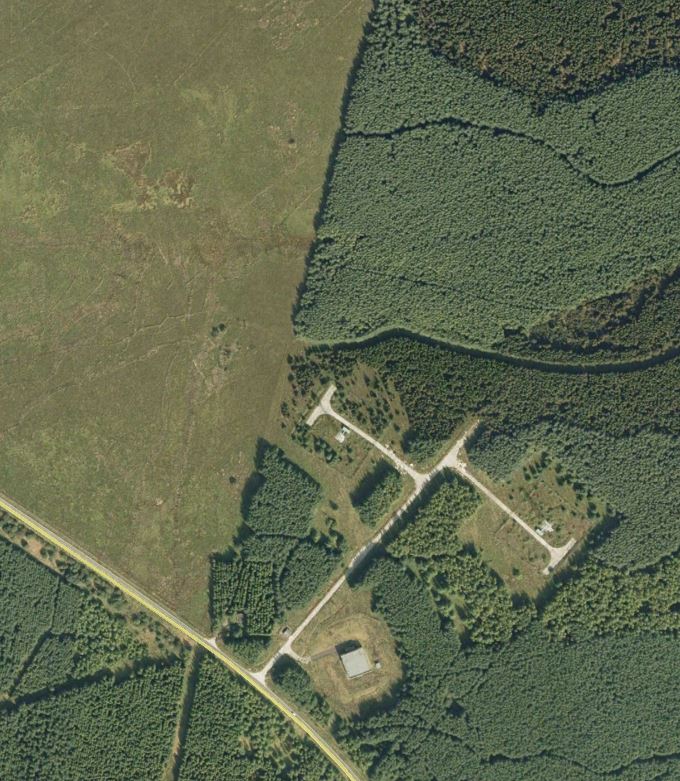
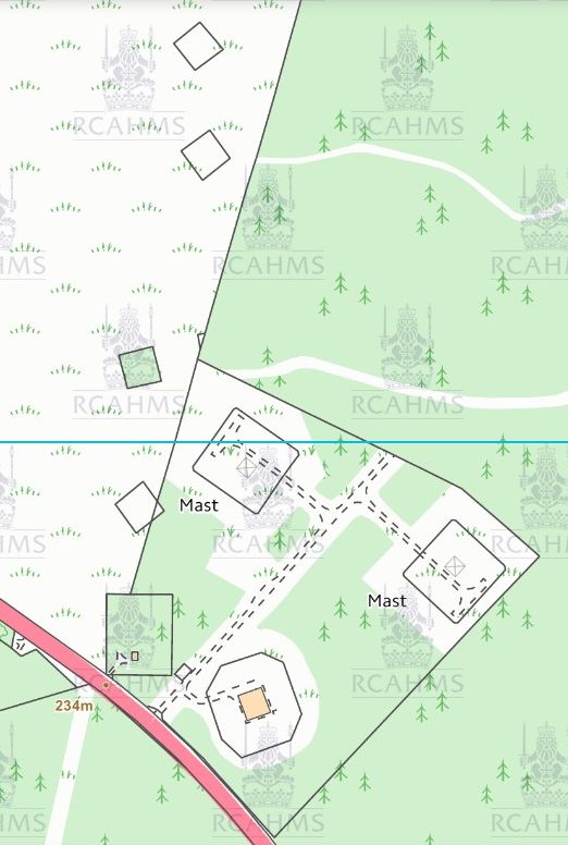
Map clipped from PASTMAP, aerial from Google Earth.
The aerial images of that area on NCAP are either very dark or blank but I don't think I can see anything.
Attached files
This image is hidden for guests.
This image is hidden for guests.
Incidentally Knockhill must be one of the few racing circuits not on an old airfield.
Map clipped from PASTMAP, aerial from Google Earth.
The aerial images of that area on NCAP are either very dark or blank but I don't think I can see anything.
Attached files
This image is hidden for guests.
Please log in or register to see it.
This image is hidden for guests.
Please log in or register to see it.
Please Log in or Create an account to join the conversation.
- canberra
- Offline
- Platinum Member
-

Less
More
- Posts: 5639
- Thank you received: 122
20 Jan 2015 16:15 #2
by canberra
Replied by canberra on topic Any sort of WT site just South East of Knockhill racing circuit?
There was (is?) a Navy WT station at Castlandhill, but that is on the south coast of Fife not far from the Forth Road bridge.
Please Log in or Create an account to join the conversation.
- mbriscoe
-
Topic Author
- Offline
- Moderator
-
20 Jan 2015 16:32 #3
by mbriscoe
No I was thinking of close to RAF Turnhouse Outhmuir. There does seem to have been something there, I have a copy of the record in the HER.
Replied by mbriscoe on topic Any sort of WT site just South East of Knockhill racing circuit?
There was (is?) a Navy WT station at Castlandhill, but that is on the south coast of Fife not far from the Forth Road bridge.
No I was thinking of close to RAF Turnhouse Outhmuir. There does seem to have been something there, I have a copy of the record in the HER.
Please Log in or Create an account to join the conversation.
- Granite
- Offline
- Senior Member
-

Less
More
- Posts: 186
- Thank you received: 8
20 Jan 2015 18:25 #4
by Granite
Replied by Granite on topic Any sort of WT site just South East of Knockhill racing circuit?
In the 'field' opposite Knockhill, there are the remains of a pillbox and a brick hut. When I was small there used to be huge radio masts in that field, sorry for the 'non technical description , but the type with a central lattice column supported by guy ropes.
Please Log in or Create an account to join the conversation.
- mbriscoe
-
Topic Author
- Offline
- Moderator
-
20 Jan 2015 18:56 #5
by mbriscoe
Replied by mbriscoe on topic Any sort of WT site just South East of Knockhill racing circuit?
The NGR in the HER record is just in the race circuit so can't see anything.
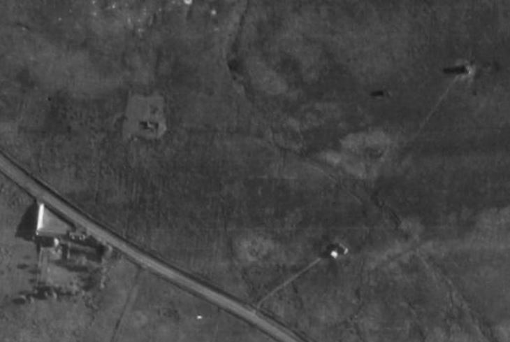
There is an anonymous looking building at NT 07133 94145 that is not on the 2nd Edition OS Map. But on this 1946 image
UNI: NCAP-000-000-114-671
Sortie: 106G/Scot/UK/0093
Frame: 3290
There is track up to it and another structure further up the hill.
Looking on Google Earth there is what is probably an octagonal structure in a square compound at NT 07227 94315
Nothing else obvious but PASTMAP and Google Earth have a series of square compounds to the East, on Google Earth I think four pairs of stayblocks can be seen in each
. The 1988 aerial image seems to show something around the two modern radio stations at NT 07643 93985 and NT 07830 93882. I think there are other sites and possibly similarly sized squares in the forest area.
Attached files
This image is hidden for guests.
OUTHMUIR.kmz
(1.2 KB)
There is an anonymous looking building at NT 07133 94145 that is not on the 2nd Edition OS Map. But on this 1946 image
UNI: NCAP-000-000-114-671
Sortie: 106G/Scot/UK/0093
Frame: 3290
There is track up to it and another structure further up the hill.
Looking on Google Earth there is what is probably an octagonal structure in a square compound at NT 07227 94315
Nothing else obvious but PASTMAP and Google Earth have a series of square compounds to the East, on Google Earth I think four pairs of stayblocks can be seen in each
. The 1988 aerial image seems to show something around the two modern radio stations at NT 07643 93985 and NT 07830 93882. I think there are other sites and possibly similarly sized squares in the forest area.
Attached files
This image is hidden for guests.
Please log in or register to see it.
Please Log in or Create an account to join the conversation.
- mbriscoe
-
Topic Author
- Offline
- Moderator
-
20 Jan 2015 19:30 #6
by mbriscoe
That figures, I mentioned below that there are a series of squares that seem to have stayblocks so guyed masts.
Replied by mbriscoe on topic Any sort of WT site just South East of Knockhill racing circuit?
In the 'field' opposite Knockhill, there are the remains of a pillbox and a brick hut. When I was small there used to be huge radio masts in that field, sorry for the 'non technical description , but the type with a central lattice column supported by guy ropes.
That figures, I mentioned below that there are a series of squares that seem to have stayblocks so guyed masts.
Please Log in or Create an account to join the conversation.
- Forum
- Open Forum
- Miscellaneous Research Topics
- General Airfield or 20th Century Military Architecture Discussion Topics
- Any sort of WT site just South East of Knockhill racing circuit?
Time to create page: 0.049 seconds